Hema Australia Truckies Atlas (7th Edition)
Brand: Hema Maps
Part number: 9781925625776
DETAILS
Overview
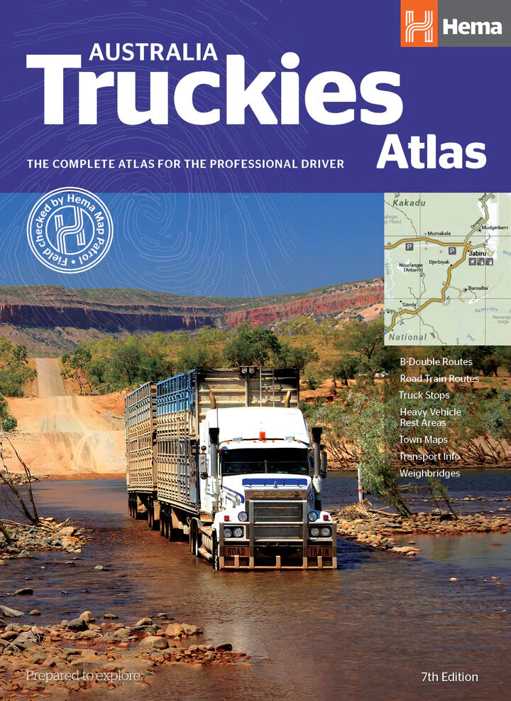
The complete atlas for the professional driver
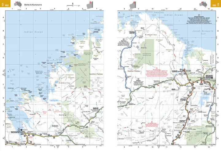
Driving heavy vehicles for a living? The Australia Truckies Atlas is a complete Hema road atlas with the extra detail professional drivers need. Every map shows B-double and road train routes, truck stops, heavy vehicle rest areas, weighbridges and low-clearance bridges.

Hema Maps has been mapping Australia since 1983, and the atlas carries the 'Field checked by Hema Map Patrol' seal. It is also handy for anyone towing a big rig who wants to know where the heavy vehicle stops are.
Plan the run
Truck routes and stops at a glance
Truck stops, heavy vehicle rest areas, weighbridges and low-clearance bridges are marked on the maps and listed in a directory with map references. The atlas is organised state by state, with suburban maps expanded in this edition.
- ✓B-double and road train routes on every map
- ✓Truck stops and heavy vehicle rest areas
- ✓Weighbridges and low-clearance bridges

Truck information

The rules and info in one place
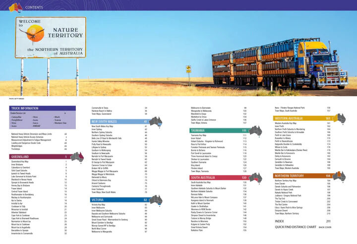
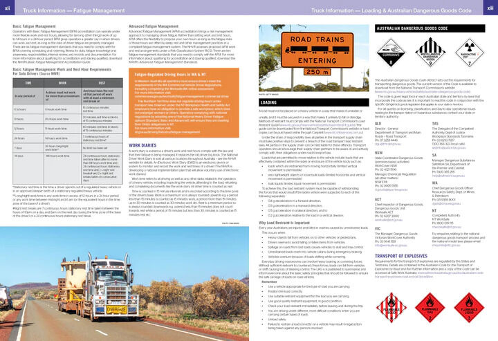
A dedicated information section covers what drivers need to know off the map, from heavy vehicle limits to fatigue rules and dangerous goods.
- ✓National heavy vehicle dimension and mass limits
- ✓National heavy vehicle access schemes
- ✓Measurement adjustment and fatigue management
- ✓Loading and dangerous goods code
- ✓Dealer and service list
Every state
Comprehensive Hema maps by state
The state maps are backed by 112 town maps with truck routes, truck stops and weighbridges clearly marked on each, from capital city suburbs to remote outback runs such as Derby to Kununurra.
- ✓112 town maps with truck routes
- ✓Expanded suburban maps
- ✓Directory with map references

Frequently asked questions
Is it only for truck drivers?
It is built for professional drivers, but it is a complete Hema road atlas, so it also suits anyone towing a big rig who wants to know where heavy vehicle rest areas and truck stops are.
Does it show low-clearance bridges?
Yes. Low-clearance bridges are marked on the maps along with truck stops, rest areas and weighbridges, and they are listed in the directory with map references.
Which edition is this?
This is the 7th edition (ISBN 9781925625776), with fully updated maps and listings and expanded suburban maps.
Does it replace official permit and route information?
No. It summarises heavy vehicle limits and access schemes, but always check current permits, notices and approved routes with the relevant road authority.
Pairs well with
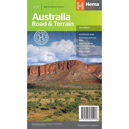
All of Australia on one sheet, with major roads, distances and terrain shading.
$15.95 · View

Compact Hema road and 4WD atlas for a second vehicle or the glovebox.
$29.95 · View

Features
- ✓B-double and road train routes on every map
- ✓Truck stops and heavy vehicle rest areas
- ✓Weighbridges and low-clearance bridges
- ✓112 town maps with truck routes marked
- ✓Directory with map references
- ✓National heavy vehicle dimension and mass limits
- ✓Access schemes and fatigue management info
- ✓Loading and dangerous goods code
- ✓Dealer and service list
Specifications
Atlas details
| Brand | Hema Maps |
| Title | Australia Truckies Atlas |
| Edition | 7th |
| ISBN | 9781925625776 |
| Town maps | 112 |
| Coverage | Australia |
What's Included
- ✓1 x Hema Australia Truckies Atlas (7th edition)
Product Details
| SKU | 9781925625776 |
| Barcode # | 9781925625776 |
| Brand | Hema Maps |
| Shipping Weight | 1.2750kg |
(9781925625776)
Hema Maps began in 1983, when Henry and Margaret Boegheim started laminating marine charts from their family home in South East Queensland, naming the business after the first two letters of their names. It grew into one of Australia's best known publishers of touring and 4WD maps, and the reason ...
Find Out MoreBe The First To Review This Product!
Help other SPC Enterprises Pty Ltd users shop smarter by writing reviews for products you have purchased.
More From This Category
Hema Where to Camp Guide Australia - 5,500+ Campsi
Hema 4WD + Camping Escapes Perth & the South West
Hema Great Desert Tracks Atlas & Guide (6th Editio
Hema The Kimberley Atlas & Guide (6th Edition) - T