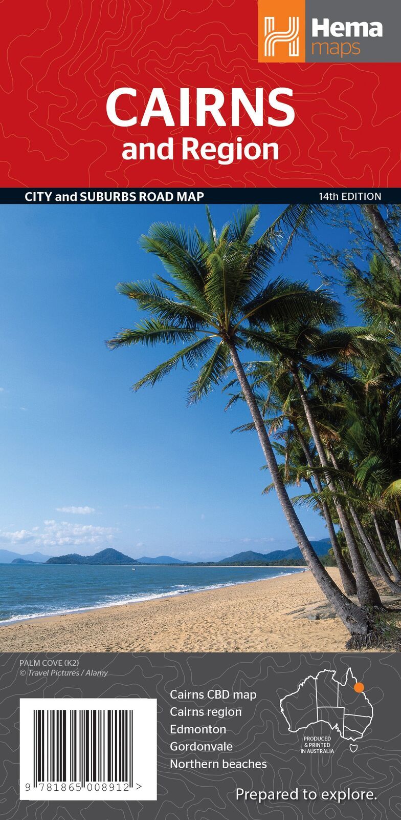
Hema Cairns & Region Map - City & Suburbs Road Map (14th Edition)
Brand: Hema Maps
Part number: 9781865008912
DETAILS
Overview
Find your way around Cairns and its beaches
Using Cairns as your base for the reef, the rainforest and the Tablelands? This Hema map has the city and suburbs at a detailed 1:22,500, with the northern beaches on the other side, so you can find the caravan park, the shops and the boat ramp without guesswork.
Hema Maps has been mapping Australia since 1983. Its maps are produced and printed in Australia, and Hema's Map Patrol team drives the roads and tracks to field-check the mapping.
What's on the map
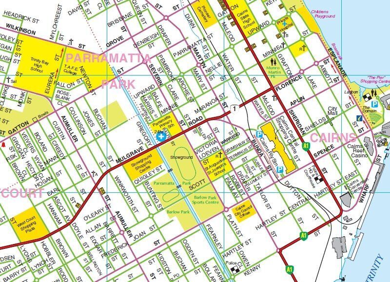
Cairns, street by street
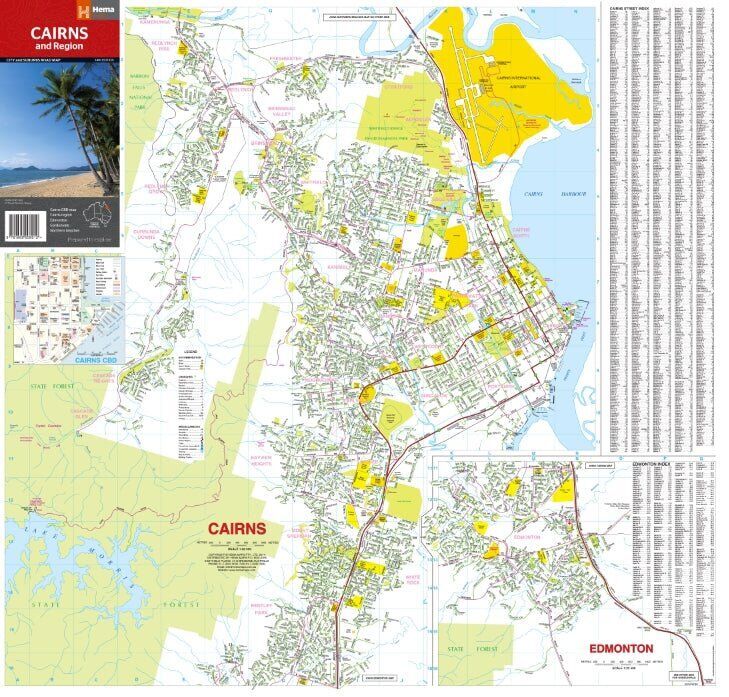
One side covers Cairns from the CBD out through the suburbs, with an Edmonton inset and a full street index alongside. Parks, state forest and key landmarks are shaded so you can orient yourself fast.
- ✓Cairns city and suburbs at 1:22,500
- ✓Cairns CBD inset map
- ✓Edmonton inset map
- ✓Street and suburb index
The other side
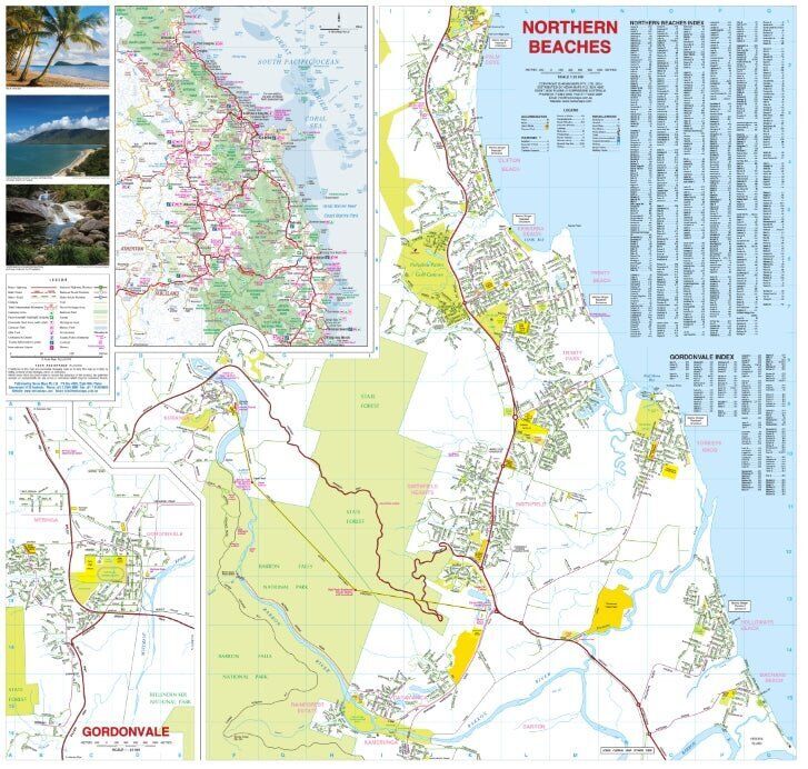
Northern beaches and Gordonvale
Flip the map for the northern beaches, the strip of coastal suburbs north of the city along the Captain Cook Highway, plus an inset of Gordonvale to the south. Each has its own index.
- ✓Northern beaches map with index
- ✓Gordonvale inset with index
- ✓Handy for coastal caravan stays north of the city
Day trips
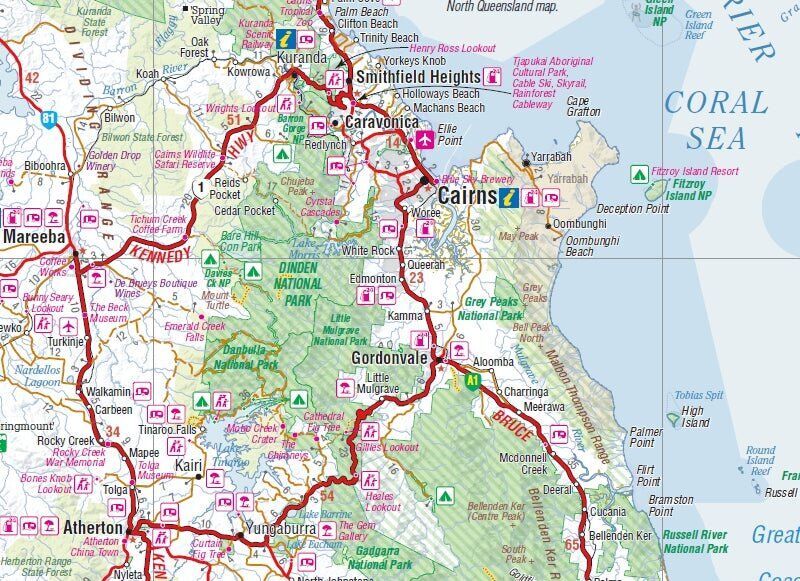
Out to Kuranda and the Tablelands
The Cairns region inset shows the roads out of town to Kuranda, Mareeba, Atherton, Yungaburra and Gordonvale, with national parks, lookouts and attractions marked. It is a quick way to plan a day trip up the range.
- ✓Regional roads and highway numbers
- ✓National parks and lookouts
- ✓Attractions and visitor information symbols
Frequently asked questions
Which edition is this?
This is the 14th edition of Hema's Cairns & Region map (ISBN 9781865008912).
What scale is it?
The Cairns city and suburbs map is at 1:22,500, detailed enough for street-level navigation.
Does it cover the northern beaches?
Yes. The northern beaches have their own map on the reverse side, with an index.
Is the map waterproof?
No. Hema prints this city map on standard paper. It folds back to glovebox size, and a Hema map wallet will keep it clean and flat between uses.
Will it get me to Cape York?
No, this is a city and region map. For the trip north, pair it with the Hema Cape York Map below.
Pairs well with


Features
- ✓Cairns city and suburbs at a detailed 1:22,500
- ✓Northern beaches map on the reverse
- ✓Insets for the Cairns CBD, Edmonton and Gordonvale
- ✓Cairns region inset out to Kuranda and Atherton
- ✓Fully indexed streets and suburbs
- ✓Parks, attractions and visitor information marked
- ✓Folds to glovebox size
- ✓Produced and printed in Australia by Hema Maps
Specifications
Map details
| Brand | Hema Maps |
| Title | Cairns & Region |
| Series | City and Suburbs Road Map |
| Edition | 14th |
| Publication date | January 2015 |
| ISBN | 9781865008912 |
| Main map scale | 1:22,500 |
| Maps and insets | Cairns, Northern Beaches, Cairns CBD, Edmonton, Gordonvale, Cairns Region |
| Paper | Standard paper |
Size & weight
| Folded size (W x H x D) | 123 x 250 x 3 mm |
| Flat size (W x H) | 730 x 700 mm |
| Weight | 70 g |
What's Included
- ✓1 x Hema Cairns & Region Map (folded)
Product Details
| SKU | 9781865008912 |
| Barcode # | 9781865008912 |
| Brand | Hema Maps |
| Shipping Weight | 0.0700kg |
| Shipping Width | 0.123m |
| Shipping Height | 0.003m |
| Shipping Length | 0.250m |
(9781865008912)
Hema Maps began in 1983, when Henry and Margaret Boegheim started laminating marine charts from their family home in South East Queensland, naming the business after the first two letters of their names. It grew into one of Australia's best known publishers of touring and 4WD maps, and the reason ...
Find Out MoreBe The First To Review This Product!
Help other SPC Enterprises Pty Ltd users shop smarter by writing reviews for products you have purchased.
More From This Category
Hema Hobart & Region Map - City Map (1st Edition)
Hema Australia Wall Map - Large 1000 x 875 mm - La
Hema North East New South Wales Map - Coffs Harbou
Hema The Red Centre Map - Alice Springs to Uluru (
Hema World Map Mural - Europe Centred - 2320 x 158
Hema Pilbara & Coral Coast Map (9th Edition)
Hema South America (North) Deluxe Map