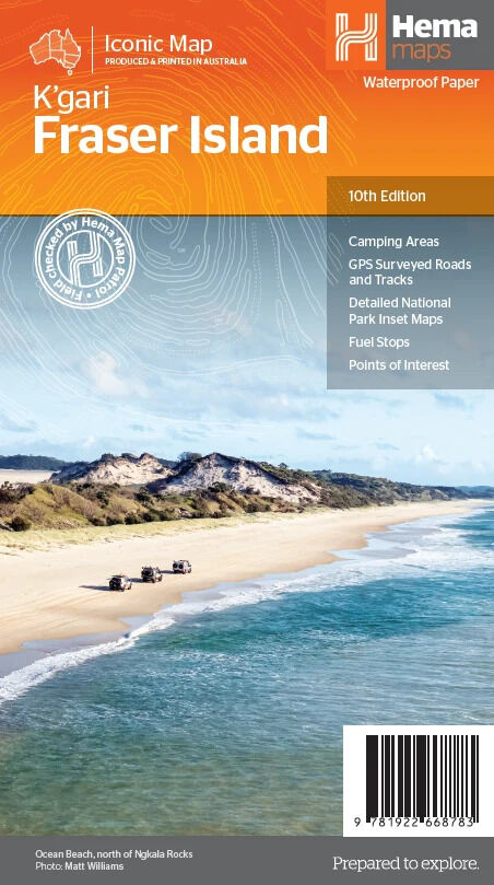
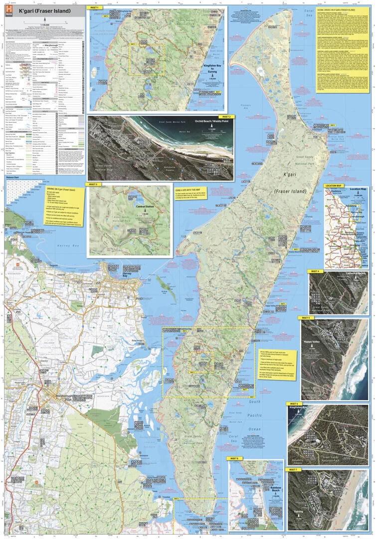
Hema K'gari (Fraser Island) Map (10th Edition)
Brand: Hema Maps
Part number: 9781922668783
DETAILS
Overview
Drive and camp K'gari with confidence
K'gari (Fraser Island) is one of Australia's most diverse 4WD destinations, with beaches, rainforests, perched lakes and sand blows on the world's largest sand island. This waterproof Hema map shows every major sand track and inland route, so you can plan the drive, the tides and the camp.

Hema Maps is Australia's trusted 4WD mapping brand. The tracks on this map are GPS surveyed and field checked by the Hema Map Patrol.
What's on the map
The whole island in detail
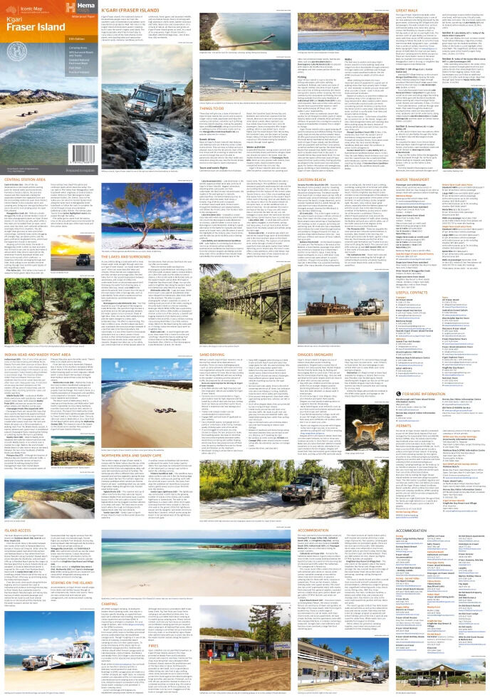
The main map covers the island at a detailed 1:130,000. Hybrid satellite inset maps zoom in on Waddy Point, Orchid Beach, Cathedral Beach, Happy Valley, Kingfisher Bay, Eurong and Second Valley, so you can see exactly where the tracks, camps and townships sit.
- ✓4WD tracks field checked by Hema's Map Patrol
- ✓GPS surveyed roads and tracks
- ✓GPS positions and grid
- ✓Satellite images of key locations

Built for the sand

Find the camp and the facilities
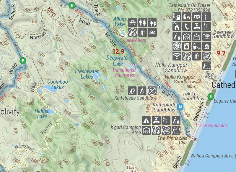
Camping areas, lakes, walking tracks and facilities are marked with clear symbols, with track distances between key points. It's printed on waterproof synthetic paper, so salt spray and wet hands won't ruin it.
- ✓Camping areas and facilities marked
- ✓Waterproof synthetic paper
Plan before you go
Touring information on the reverse
The reverse is packed with information for enjoying K'gari: touring notes on each region, things to do, island access, permit information, accommodation, useful contacts and helpful insights for sand driving.
- ✓Island access and permit information
- ✓Touring notes and things to do in each region
- ✓Sand driving tips

Frequently asked questions
Is the map waterproof?
Yes. It is printed on waterproof synthetic paper.
Does it show the 4WD tracks?
Yes. All major sand tracks and inland routes are GPS surveyed and field checked by the Hema Map Patrol.
Does it have permit and access information?
Yes. The reverse covers island access, permits, accommodation and useful contacts. Always check current permit and access requirements before you travel.
Which edition is this?
This is the 10th edition (ISBN 9781922668783), at a scale of 1:130,000.
Pairs well with

In-depth guide to K'gari plus Moreton, Stradbroke and Bribie islands.
$49.95 · View

Regional map from the NSW border to past Bundaberg, for the drive there.
$15.95 · View

Features
- ✓Detailed 1:130,000 map of K'gari (Fraser Island)
- ✓4WD tracks fully checked by Hema's Map Patrol
- ✓GPS surveyed roads and tracks
- ✓GPS positions and grid
- ✓Camping areas marked
- ✓Seven hybrid satellite inset maps of key locations
- ✓Island access, permits and sand driving tips on the reverse
- ✓Waterproof synthetic paper
Specifications
Map details
| Brand | Hema Maps |
| Title | K'gari (Fraser Island) |
| Series | Iconic Map |
| Edition | 10th |
| Publication date | May 2023 |
| ISBN | 9781922668783 |
| Scale | 1:130,000 |
| Inset maps | Waddy Point, Orchid Beach, Cathedral Beach, Happy Valley, Kingfisher Bay, Eurong, Second Valley |
| Paper | Waterproof synthetic paper |
Size
| Folded size (W x H x D) | 140 x 250 x 3 mm |
| Flat size (W x H) | 700 x 1000 mm |
What's Included
- ✓1 x Hema K'gari (Fraser Island) Map (folded)
Product Details
| SKU | 9781922668783 |
| Barcode # | 9781922668783 |
| Brand | Hema Maps |
| Shipping Weight | 0.0900kg |
| Shipping Width | 0.140m |
| Shipping Height | 0.005m |
| Shipping Length | 0.250m |
(9781922668783)
Hema Maps began in 1983, when Henry and Margaret Boegheim started laminating marine charts from their family home in South East Queensland, naming the business after the first two letters of their names. It grew into one of Australia's best known publishers of touring and 4WD maps, and the reason ...
Find Out MoreBe The First To Review This Product!
Help other SPC Enterprises Pty Ltd users shop smarter by writing reviews for products you have purchased.
More From This Category
Hema Hobart & Region Map - City Map (1st Edition)
Hema Australia Wall Map - Large 1000 x 875 mm - La
Hema North East New South Wales Map - Coffs Harbou
Hema The Red Centre Map - Alice Springs to Uluru (
Hema World Map Mural - Europe Centred - 2320 x 158
Hema Pilbara & Coral Coast Map (9th Edition)
Hema South America (North) Deluxe Map