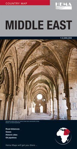
Hema Middle East Deluxe Map - Country Road Map (1:2,000,000)
Brand: Hema Maps
Part number: 9781865003184
DETAILS
Overview
A clear road map of the Middle East
Planning an overland trip, following the news or just love maps? Hema's Middle East map uses cartography from one of the world's leading map makers, with road detail that is thorough but clearly set out and easy to follow.
What's on the map
Roads, distances and history
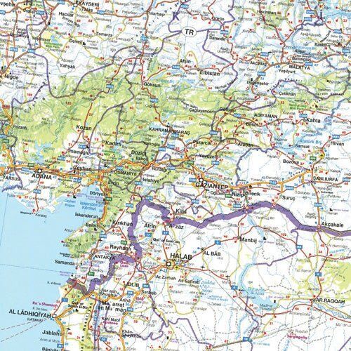
Main and secondary roads are graded and numbered, with road distances marked between towns. Oases, historic sites and oil pipelines are shown across the region, along with borders and terrain colouring.
- ✓Road distances
- ✓Oases
- ✓Historic sites
- ✓Oil pipelines
Built to last
Protective coated cover
The map is printed on paper and folds into a protective coated card cover, which helps it survive being packed, unpacked and refolded on the road.
- ✓Folded map in a coated card cover
- ✓Easy to read road detail
Frequently asked questions
What scale is the map?
The map is at 1:2,000,000.
Which edition is this?
This is the 2nd edition of Hema's Middle East map (ISBN 9781865003184).
What does it show?
Comprehensive road detail with road distances, oases, historic sites and oil pipelines.
Is it waterproof?
No. It is printed on paper, with a protective coated card cover.
Pairs well with
Features
- ✓Road map of the Middle East at 1:2,000,000
- ✓Cartography from a leading international map maker
- ✓Comprehensive, clearly presented road detail
- ✓Road distances marked
- ✓Oases and historic sites
- ✓Oil pipelines
- ✓Protective coated card cover
Specifications
Map details
| Brand | Hema Maps |
| Title | Middle East |
| Series | Country Map (Deluxe) |
| Edition | 2nd |
| ISBN | 9781865003184 |
| Scale | 1:2,000,000 |
| Paper | Paper with coated card cover |
| Weight | 160 g |
What's Included
- ✓1 x Hema Middle East Deluxe Map (folded, in coated card cover)
Product Details
| SKU | 9781865003184 |
| Barcode # | 9781865003184 |
| Brand | Hema Maps |
| Shipping Weight | 0.1600kg |
| Shipping Width | 0.140m |
| Shipping Height | 0.005m |
| Shipping Length | 0.250m |
(9781865003184)
Hema Maps began in 1983, when Henry and Margaret Boegheim started laminating marine charts from their family home in South East Queensland, naming the business after the first two letters of their names. It grew into one of Australia's best known publishers of touring and 4WD maps, and the reason ...
Find Out MoreBe The First To Review This Product!
Help other SPC Enterprises Pty Ltd users shop smarter by writing reviews for products you have purchased.
More From This Category
Hema Hobart & Region Map - City Map (1st Edition)
Hema Australia Wall Map - Large 1000 x 875 mm - La
Hema North East New South Wales Map - Coffs Harbou
Hema The Red Centre Map - Alice Springs to Uluru (
Hema World Map Mural - Europe Centred - 2320 x 158
Hema Pilbara & Coral Coast Map (9th Edition)
Hema South America (North) Deluxe Map