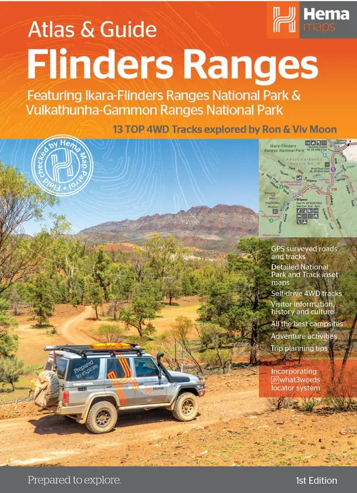
Hema Flinders Ranges Atlas & Guide (1st Edition)
Brand: Hema Maps
Part number: 9321438001676
DETAILS
Overview
Explore the Flinders Ranges end to end
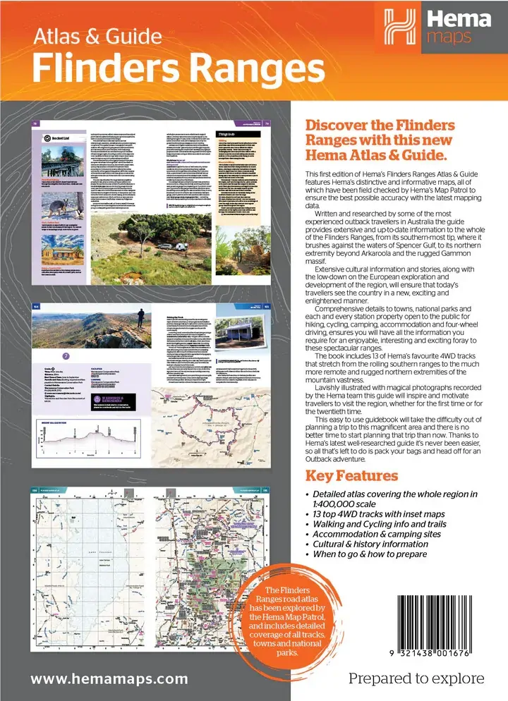
Heading to Wilpena Pound, Arkaroola or the Gammon Ranges? This atlas and guide covers the whole of the Flinders, from the southern tip on Spencer Gulf to beyond Arkaroola, with Hema's 13 favourite 4WD tracks, the best campsites and everything you need to plan the trip.

Hema Maps has been mapping Australia since 1983. The maps in this guide are field checked by the Hema Map Patrol, and the guide is written and researched by experienced outback travellers including Ron Moon.
4WD tracks
13 of the best drives in the ranges
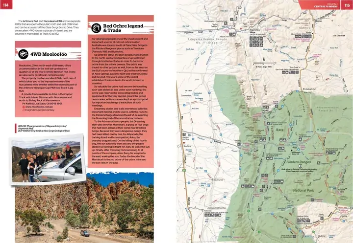
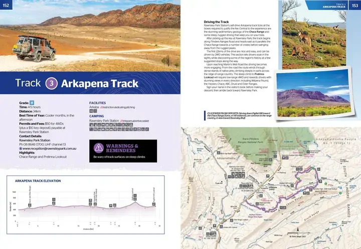
Hema's 13 top 4WD tracks run from the rolling southern ranges to the remote, rugged north. Each track comes with an inset map, an elevation profile and the planning details: grade, time, distance, best time of year, permits and fees, camping and contacts.
- ✓Inset map for every track
- ✓Track elevation profiles
- ✓Warnings and reminders for each drive

Region by region

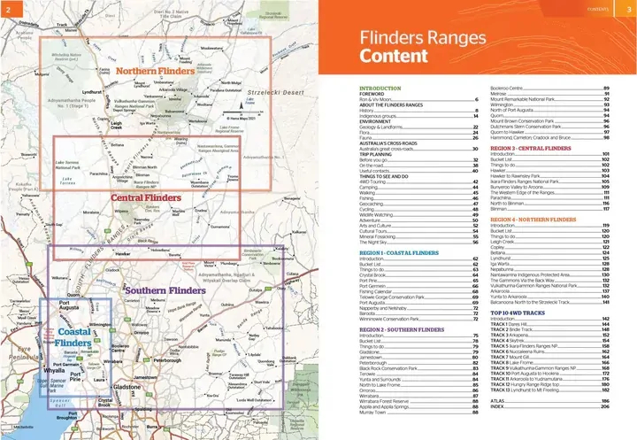
Coastal, Southern, Central and Northern Flinders
The guide is split into four regions, each with its own introduction, bucket list and things to see and do. There are details on towns, national parks and the station properties open to the public for hiking, cycling, camping, accommodation and 4WD touring.
- ✓Accommodation and the best campsites
- ✓Walking and cycling trails
- ✓When to go and how to prepare
Know the country
Culture, history and landscape
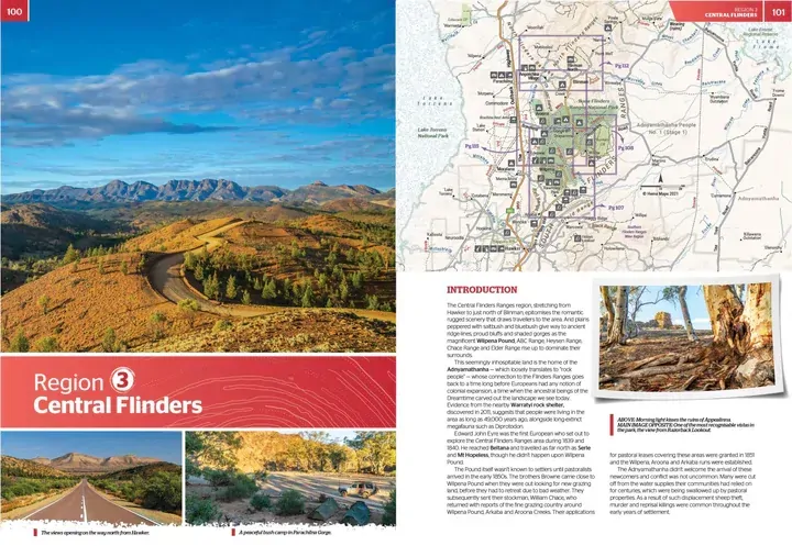
Extensive cultural information and stories sit alongside the history of European exploration and development, so you see the ranges in a new light. The book is illustrated throughout with photography by the Hema team.
- ✓Featuring Ikara-Flinders Ranges and Vulkathunha-Gammon Ranges National Parks
- ✓Cultural and historical information
- ✓Incorporates the what3words locator system

Frequently asked questions
Which areas does it cover?
The whole Flinders Ranges, from the southern tip near Spencer Gulf to the northern ranges beyond Arkaroola and the Gammon Ranges, split into Coastal, Southern, Central and Northern Flinders.
Do I need a 4WD to use this guide?
No. It covers towns, national parks, walks, cycling and accommodation as well as the 13 4WD tracks, so it is useful for any visitor to the ranges.
Is there a road atlas in the book?
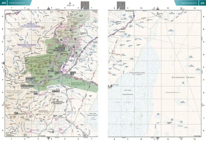
Yes. A 20-page atlas covers the whole region at 1:400,000, and each 4WD track has its own inset map.
Which edition is this?
This is the 1st edition of Hema's Flinders Ranges Atlas & Guide (barcode 9321438001676).
Pairs well with

Waterproof Flinders Ranges map with national park insets and visitor information.
$15.95 · View

Head north from the Flinders on the Strzelecki, Birdsville or Oodnadatta Track.
$69.95 · View

Holds one A4-size atlas or book plus four folded maps in one place.
$34.95 · View
Features
- ✓Hema's 13 top 4WD tracks in the Flinders Ranges
- ✓Inset map and elevation profile for every track
- ✓20-page atlas of the whole region at 1:400,000
- ✓Field checked by the Hema Map Patrol
- ✓Accommodation and the best campsites
- ✓Walking and cycling info and trails
- ✓Cultural and historical information
- ✓When to go and how to prepare
Specifications
Book details
| Brand | Hema Maps |
| Title | Flinders Ranges Atlas & Guide |
| Edition | 1st |
| Barcode | 9321438001676 |
| Pages | 208 |
| Atlas | 20 pages at 1:400,000 |
| 4WD tracks | 13, with inset maps |
| Locator system | what3words |
Weight
| Weight | 955 g |
What's Included
- ✓1 x Hema Flinders Ranges Atlas & Guide
Product Details
| SKU | 9321438001676 |
| Barcode # | 9321438001676 |
| Brand | Hema Maps |
| Shipping Weight | 0.9550kg |
(9321438001676)
Hema Maps began in 1983, when Henry and Margaret Boegheim started laminating marine charts from their family home in South East Queensland, naming the business after the first two letters of their names. It grew into one of Australia's best known publishers of touring and 4WD maps, and the reason ...
Find Out MoreBe The First To Review This Product!
Help other SPC Enterprises Pty Ltd users shop smarter by writing reviews for products you have purchased.
More From This Category
Hema Australia Truckies Atlas (7th Edition)
Hema Where to Camp Guide Australia - 5,500+ Campsi
Hema 4WD + Camping Escapes Perth & the South West
Hema Great Desert Tracks Atlas & Guide (6th Editio
Hema The Kimberley Atlas & Guide (6th Edition) - T